Melt / Rise
Climate change and the global interconnectedness of water
by Cymene Howe
“An ocean erases everything that is written in sand.”
— Oral Traditions, by William Nu’utupu Giles and Travis T.
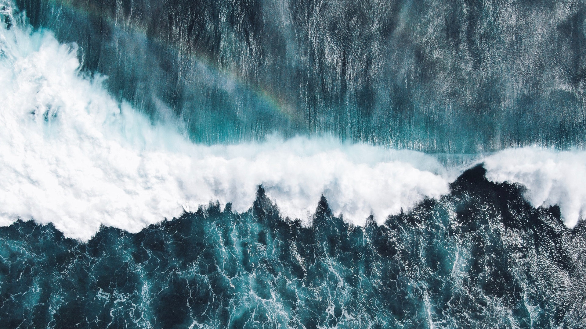
For ocean scientists, water encircles the Earth in a relatively uninhibited interchange and transference across the world hydrosphere. The seas of the planet are one body, in fact, never quite captured in a name—Pacific or Indian or Atlantic. And this world ocean does not just lie there inert and subdued. Its motion is constant, in tides, currents, and conveyors. Its movement is also skyward, rising-up into the atmosphere, evaporating into clouds, and returning as rain and snow, sleet and storm. A hydrological cycle of watery interplay. As such, the world ocean erodes and carries, flows and sweeps. As anthropologist Hi’ilei Julia Hobart reminds us, “Water’s nature is diasporic. It transits and carries and adapts to environments whether engineered, neglected, or carefully preserved. Often, it misbehaves in such a way that reminds humans of the limits of their own power and control.” Its disobedience is its magic.
Bodies of water have always held a special place in our collective human imagination. Water is a life force that sustains all living beings; it is also a life space that creates environments and ecosystems for organisms to thrive. In many cosmological systems, bodies of water are also life forms, sentient beings, with powers uniquely theirs and forever interacting with other beings around them. But bodies of water in these times of environmental distress are becoming infused with new meanings and new potentials as they are impacted by human-created heat now channeled into the world’s waters through rising atmospheric temperatures and a warming earth.
Think, for example, of the water called ice. At the southern pole of the world, the frozen continent of Antarctica has lost almost six-trillion- five-hundred-billion tons of ice in the last thirty years. In the Arctic north, heat is turning glaciers and ice sheets into meltwater faster than anywhere else on Earth. We know that these sites of melt are pouring vast quantities of water into the world ocean. Arctic glaciers, as they are transformed from solid to liquid, now represent the source of more sea-level rise than any other: more than the distending effects of oceanic thermal expansion and more than the disintegration of the icy continent on the southern end of our planet.
At the southern pole of the world, the frozen continent of Antarctica has lost almost six-trillion- five-hundred-billion tons of ice in the last thirty years.
I am not a glaciologist or an oceanographer. I am a cultural anthropologist who wants to understand the social consequences of a melting world. For several years, I’ve been studying the loss of ice in places where it has long been a part of lives and landscapes. My focus has centered on how people understand their environments and all that is sustained by them, historically and in the present, and how that is being transformed by climate change. In the course of this work, my research partner and I came across Okjökull—the first of Iceland’s major glaciers to be destroyed by climate change. Scant attention had been given to Okjökull’s passing, and so we enlisted a handful of Icelandic colleagues and held a public funeral for the little glacier called Ok; it was the world’s first memorial for a glacier and was covered by media outlets all over the world.
In trying to understand the social impact of melting ice, I have also been keenly aware of the other end of this geohydrological event, namely, the rise of seas brought on by the melt of ice. And so I began to ask: What if we could follow the water from our melting glaciers to the coasts of the world where glaciers now manifest as sea-level rise? Where would we go and what stories would we find along the way? Is the ice that has now become water creating routes and passages of connectivity between otherwise distant places? If so, how might melting ice, transformed into rising seas, tie us together across continents through the connective reach of the world ocean?
Mary Douglas, a cultural anthropologist writing in the mid-twentieth century, thought quite a lot about what she called “matter out-of-place.” She wrote specifically, and quite eloquently, about dirt. Dirt was an idea. But it was also a substance that might be just fine over there, on the “outside,” but that was never welcome here, on the “inside.” Indeed, some dirt, when out-of-place, could even rise to the level of taboo.
Water moving outside of its usual boundaries is, of course, much more than a philosophical question. It is a painful, sometimes deadly, reality in times when extreme storms, sea-level rise, and floods are increasingly flowing into our lives and over our doorsteps. Douglas’s meditation on dirt still reveals attitudes that many people continue to hold about how earthly, or watery, substances can be made to remain under human control. Like dirt, we may want water to stay in its place. But that human conceit of control is being increasingly challenged in times of anthropogenic climate change, when there is a lot of matter—in fact many matters—out-of-place. Although responsibility for these outcomes or their impacts are not equally shared, it is clear that momentous environ- mental changes are upon us, and we are collectively struggling to manage all that is now out-of-place, including water in the form of sea-level rise, storms, and floods.
Water moving outside of its usual boundaries is, of course, much more than a philosophical question. It is a painful, sometimes deadly, reality in times when extreme storms, sea-level rise, and floods are increasingly flowing into our lives and over our doorsteps.
As ice continues to transform around the world, we have now started to follow its water from once-frozen places to others, where the ocean swells and rises. In this multi-year research project, supported by the US National Science Foundation, we begin in the Arctic region and then land in coastal cities further to the south. Part of this work involves trying to unravel how water in motion is being charted and graphed by scientists. Another part of this work requires asking questions about how communities, industries, government officials, and others are coping with ice loss or, alternately, bracing for sea-level surges. I am interested in how these responses, or “adaptations,” might be similar or different across sites, not only in terms of their adaptive actions—like the installation of seawalls or new infrastructures to control overflowing glacial rivers—but also how these responses are scaled, across time and space, as well as the political and economic commitments behind them. Equally important to me is how local communities are reckoning with these tremendous changes in their local environments and how this may result in a sense of loss, or outrage, or even hope for new possibilities.
The relationship between a changing cryosphere—Earth’s ice—and its precise impact on sea levels along the world’s coasts has been very challenging for scientists to track. In part, that is because the “bathtub model” predominates in many climate projections— showing us simply how the volume of meltwater adds to the world ocean but not how it manifests very differently in coastal locations according to a whole host of criteria, including local currents, subsidence, and erosion, to name a few. But a group of physicists at NASA has recently created a way to map this relationship. Their model, called the Gradient Fingerprint Map (or GFM), can calculate where specific sites of melting ice will appear as sea-level rise in 293 of the world’s coastal cities. By pinpointing mass and meltwater contributions from each major glacial basin on Earth—from the Himalayas to Antarctica and from the Canadian Arctic to the Southern Andes—the model demonstrates a precise relationship between lost ice and sea-level gain. In short, it shows how Earth’s gravitational and rotational processes, as well as the redistribution of mass, are contorted by the melting of the world’s ice and how that influences the world ocean on a planetary scale.
When we try to follow meltwater in its passage to become sea-level rise elsewhere, we learn that, unlike the borders drawn on maps, the movement of the world’s water does not conform to a linear path. In a sense, there is no path at all but instead a contortion of earth’s “liquid envelope.” As meltwater from glaciers and ice sheets conjoins with the world ocean, the planet’s gravity, as well as its rotation, are shifted, creating different spatial patterns of sea-level rise around the world. In one of our conversations, Eric Larour, a lead physicist in the development of the GFM tool, described it like this: “It’s like a spinning top. If you could modify the spinning top while it rotates, maybe touch it and remove some mass, it will start wobbling very differently. . . [A]s soon as you remove a bit of mass from that big giant spinning top, which is the Earth, the rotation axis of the spinning top wants to move towards the mass that was lost.” Drawing upon the physics of shifting ice and water, the GFM tool allows users to see with precision where melting ice results in specific amounts of sea-level rise in particular cities the world over. It shows, for instance, that Cape Town, South Africa, is more affected by Icelandic melt than any other city in the world, and that Greenlandic melt impacts sea level rise in Honolulu, Hawaii, more than any other city in the United States.
The world ocean is not simply water in motion, however, it is also in concert with ice, connecting points on the globe in rather counterintuitive ways. The consequences of a melting world and its effects on the world ocean and those of us—indeed all of us—impacted by it cannot focus only on the physics of displaced water as an Anthropocene fugitive. Instead, we ought to look to the multiple (and multiplying) socio-natural interconnections that are made through these processes. Can we begin to think of this watery diaspora as a kind of hydrological globalization? A set of planetary relationships that may not have been uniquely created by a warming climate but which are made more apparent, and perhaps urgent, by the rapid transformation of the world’s hydrosphere?
The concept of “globalization” proliferated at the end of the Cold War, when neoliberal capitalism became the economic norm on a planetary scale; originally this was meant as economic globalization. But very quickly in the human sciences, globalization came to designate many more processes, including links of trade and migration, financial markets, and the circulation of media. Conceptually, these accounts of human exchange and movement were predicated upon ideas of circulation and the flow of ideas, persons, capital, and so on. Theories of globalization have generally ignored the physical drivers of global transformation, such as the Earth system, in their analyses of social outcomes. But the concept of globalization requires rethinking in the Anthropocene— this time of exceptional, traceable, pervasive human impact. Ideas about globalization need reworking not only because human movement across borders or the direction of commodities may be changing, but because the natural world is perceptibly transforming all around us. Places, things, and people are now being markedly altered by changing biospheres, atmospheres, cryospheres, lithospheres, and hydrospheres in ways that can be empirically tracked and diagnosed. This demands new ways of reckoning with globalization as a process that is not simply market-oriented or even explicitly human-focused, but instead attentive to the socio-natural connectivities brought about by an altered earth.
The concept of globalization requires rethinking in the Anthropocene.
As the world’s water becomes distributed in unexpectedly new ways under the impact of anthropogenic forces—through a collapsing cryosphere and sea-level rise, extreme rain events and groundwater depletion—the concept of hydrological globalization signals the emergent connections between water in motion and responses to it. Hydrological globalization emphasizes global connectivities not primarily through links of trade, migration, finance, or media, but rather through physical relationships created as our hydrosphere is reshaped. Conceptually, it allows us to follow the impacts and uptakes of watery rearrangements—connecting geo- graphical sites, both materially and socially, by literally connecting them through their water.
Global hydrological changes are affecting, and will continue to affect, every population on Earth—as waters move and transform through storms and drought, melt and rise. What ties of hydrological connectivity might be arising in this process? What are the deep blue threads they reveal? As these strands begin to become woven together, we hope that our research may share not only the diver- gences but also the similarities across places and populations experiencing both melt and rise. We imagine these connections as a kind of “Sister Cities of the Anthropocene” that could be marked in informative maps and graphical visualizations, ultimately informing public and environmental policies based on hard-science conclusions that clearly link distant places through the interconnectivity created by a world ocean being reshaped by global climate change.
Share This